
_AUG2020%20(1).png?width=112&height=24&name=Sensat_Logo_(noR)_AUG2020%20(1).png "Sensat_Logo_(noR)_AUG2020 (1)")
Quality-assured data capture with drones
Easily capture and visualise highly-accurate topographical survey data, with the UK's leading provider







Why Sensat?
- Collect data faster, safer and more cost effectively than traditional methods.
- Easily visualise your project data and collaborate with an unlimited number of colleagues.
- Make more informed decisions, with access to more accurate data in real-time.
- Increase productivity by 30% and save up to 4% of costs by keeping your project on track.
Our work speaks for itself
- 100% safety record
- Constructionline Gold Standard
- Achilles UVDB Approved
- Network Rail and HS2 approved suppliers
- RICS-verified
Why use drone surveys for your project?
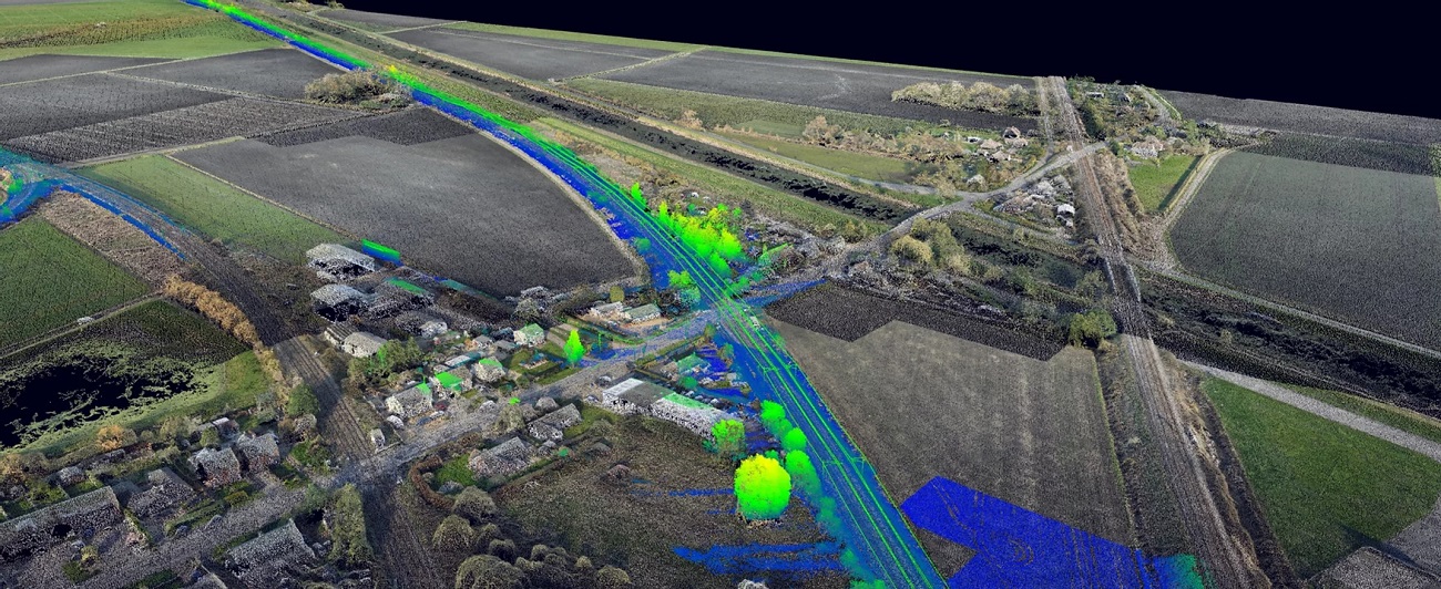
We use the latest drone technology to capture high-resolution topographical survey data, to create an accurate snapshot of your site so you can keep pace and make better project decisions in real-time.
If you’re looking at options for data capture, then choosing a solution from Sensat can help you better understand data, reduce risk, enhance collaboration and meet project deliverables.
1. Collect data in hours rather than days, and avoid lengthy approval delays.
2. Work safer removing your team from
the ground.
3. Work with outputs in any format for bidding, design, planning and site monitoring.
4. Better decision making with accurate 2 and 3D survey data that can be classified into RICS Band E survey specification.
5. Full data visualisation
"Sensat is a real game-changer. It has aided our visual clash detection and planning, significantly reducing the time taken in the process. It has also made tying our survey and design data together a breeze." Ian Holden, Head of Construction at Osborne
"Sensat’s drone data capture service and software enabled us to accelerate the infrastructure design programme whilst also providing a powerful tool for future public consultation." Aaron Wadhams, Berkeley Group, Strategic Land Technical Director
"The speed of drone data capture over a large survey area has significant cost benefits over the more traditional survey techniques." Andrew Vipas, BAM Nuttall Project Manager